Distance: 16.2 miles
Elevation Gain: 2840 ft
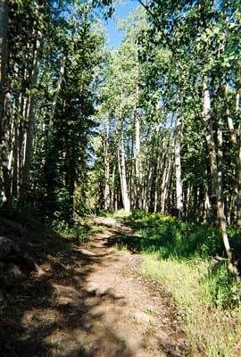
Climb Every Mountain. And Climb and Climb and Climb
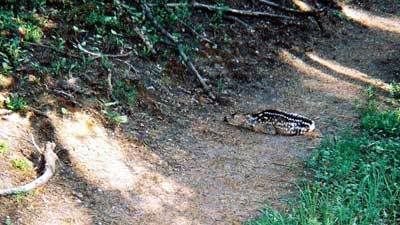
That's not entirely true; one bright spot came when I almost tripped over a very young fawn lying directly on the path. It's common for the mothers to leave new-borns unattended for hours or even days while they forage for food; however usually they hide them better than this. I had to wonder if the little rebel had done a spot of exploring on his own, then hunkered down when I came along. Either way, he didn't so much as twitch while I left the track and took a wide excursion around him.
So on and on I climbed, with the track only getting steeper. Stopping for a breather was no pleasure either because of the mosskeeters that descended upon me with glee if I so much as slowed my pace. "Mosskeeters can't live at this altitude" my ass. There were times when I had to go around fallen trees as they were just too big to climb over and each delay felt like a slap in the face.
I met two middle-aged guys hiking the other way (downhill, what a concept!) and they cheerfully explained that I had a lot of climbing ahead of me. Mutter, mutter, mutter. At somewhere around 10,000 feet I walked through my first snow of the trail. Only a small slushy patch but considering this is the first day of summer, still intriguing.
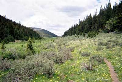
Good news is, the steep climbing was now over and after an early lunch, I set out on the long, slow grind up the valley. Nothing like the same altitude gain, but still climbing, climbing, climbing.
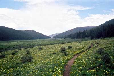
I consoled myself that at least I was lasting 45 minutes or so between breaks, unlike the 4 or 5 minutes I was managing on Day 2, but even so, the head of that damn valley just never seemed to get any closer and I was a weary little hiker by the time I finally crested the summit a little after 3 pm. 2 miles more to go and downhill all the way, but by now I was so utterly banjoed, I couldn't really appreciate it.
Naturally, the rain which had been threatening since this morning finally got going as I was setting up camp. And the mosquitoes followed me there and drove me indoors by 8pm. And the freeze dried "food" I'd brought for dinner tasted every bit as vile as you'd imagine.
But when I put down my book and snuggled into my sleeping bag I was asleep in moments. And I stayed asleep until morning and you can't complain about that.
4 comments:
I am reading your blog on the Colorado Trail and enjoying it. I would really enjoy this adventure but I am not the type to do it on my own though. I have always dreamed of tackling the Appalachian Trail but can't find any friends with the time to do it.
How do you manage to write your Blog while camping out?
Hope you got your "piece of cake" at the end of your trip.
Wayl, I cheated a little bit in that I merely took notes while on the trail. I didn't write and update the Blog entries till I got home.
Looks like you've done some major hikes yourself. I'm impressed.
Cheers
A
I could barely climb stairs in Colorado. I'm throughly impressed.
I'd need a tank of oxygen earlier in the week, I know that for sure! 45 minutes between breaks is excellent. Again, the photos of the scenery are stunning. That baby fawn is precious.
I don't envy the hard work but I'm still envious!
Post a Comment