Friday, June 29, 2007

The Colorado Trail ~ Day 3

Forest Service Road 550 to Forest Service Road 560 (Wellington Lake Road)
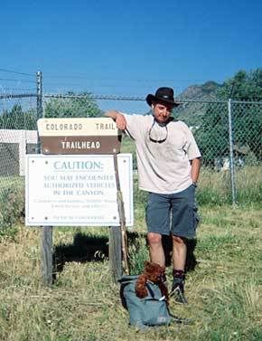
Distance: 12.1 miles
Elevation Gain: 1520 ft
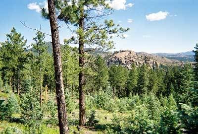
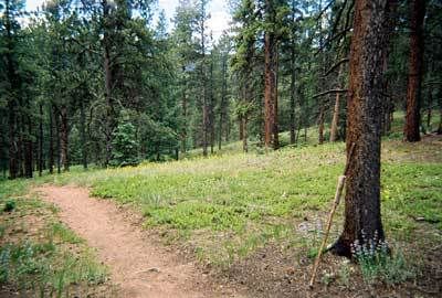
Pain? What pain?

Oh yes, this is more like the thing. Dumped that horrendously heavy pack at home and I'm back to a daypack with nowt inside but a map, the directions, some food and a day's worth of water. I had a good night's sleep, I've got moleskin slapped over me blisters and I'm having fun again. Not only that; today's portion starts off downhill. Even better, but we keep going downhill, for mile after glorious mile. How cool is that?

I could tell it was going to be a good day when the raven serenading me from the tree-tops gave me a gift of a feather before I'd gone more than a few hundred yards. I didn't trust it to stay in my hatband so I tucked it carefully in the side pocket of my shorts and tried not to biff it with each stride.

Photo Sharing and Video Hosting at Photobucket

The forest here is a mix of ponderosa pines, bristlecone pines and aspens which perform admirably as shade from the sun. There's something very Lord of the Rings-ish about it all (but without all the wraiths and scary stuff). Instead, I'm treated to a symphony of birdsong as I stride along, astonished at the time I'm making. The halfway point comes and goes well before 10:00 and considering that yesterday at this point, I'd been doubled over and almost crying in exhaustion and pain, life is very, very good.

Photo Sharing and Video Hosting at Photobucket


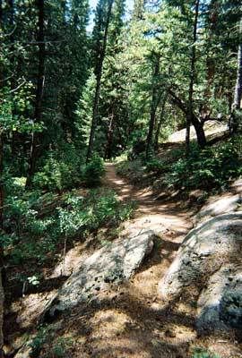
Almost made my first goof of the trail though, by not looking closely enough at the sign by an intersection and carrying straight on when I should have made a right turn. Luckily it was only a few hundred yards further that another trail intersection brought this to my attention and it only took a few minutes to get back on track. Could have been a lot worse though so I'll need to watch that on the remoter sections.

Photo Sharing and Video Hosting at Photobucket

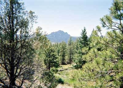
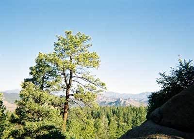
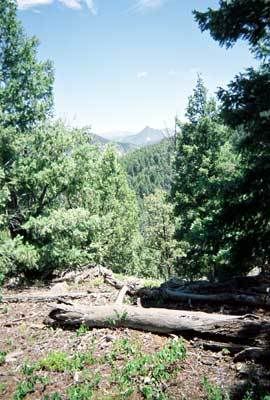
Lunch was scoffed on the banks of Buffalo Creek, not too far from where Sasha, The World's Most Irritating Dog™ and I often come on our Saturday hikes. The creek babbled beside me as I lay in the sun-dappled shade and wondered if anything could possibly spoil this moment.

Of course, when you ask a question like that, the gods are sure to answer.

Mosquitoes. F***ing mosquitoes here in my beloved Colorado. What the hell is that all about? When we were looking to relocate from Arizona, one of my primary stipulations was that there were to be NO mosquitoes. Hate them, hate them, hate them. And indeed, in the 5 years I've lived here, I've only seen 2 (and been bitten by both of them), which is manageable. I'd always believed they couldn't live at this altitude, but here was a whole herd of them, swarming all over me and biting lumps of my arms and legs like sodding piranhas. No after lunch nap for me then and I was soon back on the trail, spirits lifting once more.

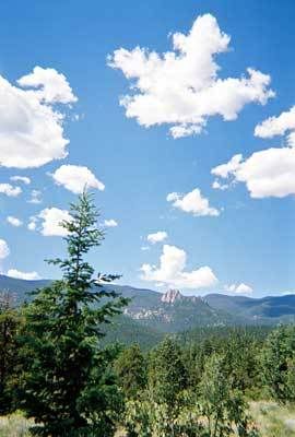
Not too much other wildlife around today and I didn't even see my first humanoid until I was within quarter of a mile from the end; a mountain biker huffing his way up the rise from the trail head. As I was heading downhill, I politely stepped off the path but he stopped and waved me through.

"You have right of way." He gasped, which was technically correct but under the circumstances, it was a lot easier for me to stop. Perhaps, like me when I'm mountain biking uphill, he was just glad of any excuse to take a break.

Photo Sharing and Video Hosting at Photobucket


So look at this, 12:25 pm and I'm done for the day. If I could, I would cheerfully have continued on and knocked off some of tomorrow's miles too, but there's no convenient way to begin tomorrow's hike except from here. That'll do then. Home to a cold one from the fridge and a lie in the hammock with me book.

Colorado Trail? Easy-Peasy.

This is going to be a piece of cake.

Wednesday, June 27, 2007

The Colorado Trail ~ Day 2

South Platte Canyon to Forest Service Road 550
Distance: 10.8 miles
Elevation Gain: 2200 ft

Welcome to the House of Pain

Remember I was talking about the challenges of packing light? Well, it was apparent very early on in Day 2 that I’d failed miserably. It was true, I probably didn’t need the entire set of encyclopedias, and I could probably have left the outboard motor at home but everything else had seemed necessary when I was cramming it all in last night. Not very much of it seemed necessary now as I crawled my way up the cliff side which began at the trail-head.
Photo Sharing and Video Hosting at Photobucket

It didn’t help that the weather was unseasonably warm, even for June and that on this stretch of the Colorado Trail there’s no shade following the Buffalo Creek fire of 1996. The grasses of the burn area are recovering, but the remains of the trees still stand like so many blackened statues and offered no respite from the blazing sun. In addition, this segment of the trail has no water, which means it all has to be carried. Not just enough for today, but for tonight’s camp and a good portion of tomorrow morning’s hiking too. And water’s bloody heavy.


Photo Sharing and Video Hosting at Photobucket

It was soon clear that I was in trouble. Not just tired, but staggeringly, crying out in pain, how the hell am I going to get out of this trouble. The trail stretched onwards and upwards, with no drop in elevation on today’s schedule yet each step was physically painful. The hotspots on my feet which had concerned me yesterday, had now developed into full blown blisters (I’ve never had blisters from hiking) and the straps of my pack were cutting into my shoulders unmercifully.

It wasn’t long before my plan of “taking a break every hour”, went to “taking a break every thirty minutes” to “taking a break every few hundred yards”, bending double to ease the pain in my back and suck in the small amount of oxygen available at 8,000 feet above sea level.

I tried giving myself inspirational speeches about winners versus quitters; I tried admiring the scenery (which was spectacular, with views of Chair Rocks in the west, down to Pikes Peak in the south – one of the unintentional benefits of being in a forest decimated by fire) and counting my steps to make the journey pass. But it was no good; I couldn’t do this. Before I'd reached the halfway point, I could barely put one foot in front of the other, my feet and shoulders were on fire and my back was beginning to spasm.


Photo Sharing and Video Hosting at Photobucket

But as far as the Colorado Trail is concerned, I haven’t even begun to gain altitude and 90+ degree heat is forecast to last all week. Things are only going to get worse. What finally finished me off was when I passed two athletic looking college-aged guys lying prostrate on the trail, almost asleep. “This sucks man” one of them said, “I don’t think we can do this.” If these two young studs were suffering, what chance did I have? Day 2, only 20 miles into the trail and I was already beaten. How thoroughly depressing.

Have I ever extolled the virtues of cell phones? Oh sure, they’re annoying enough when some yuppie is bawling into one while you’re trying to read the books for free at Barnes and Noble, or when he’s riding your butt on the highway, obliviously nattering into his electronic pacifier. But when you’re out on the trail and in need of rescue, they’re a life-saver, let me tell you. Assuming you can get service that is. I couldn’t, all though by doG did I try. Each time I stopped, which was by now every couple of minutes I would check once more. Still nada, but the thing was, at last now I had a plan.

Photo Sharing and Video Hosting at Photobucket

You see the end of today’s segment, is really quite close to my house. Only about thirty minutes drive away. And at the house was a wife. And a car with an almost full tank of gas. And if I could just get hold of her, I could demand she come and get me, and whisk me off to a shower, and a soft bed, and some beer. But most importantly, the chance to re-pack this damn bag and get rid of half the stuff inside. Then I could start the trail anew. Beaten? Me? Naah.

It was late in the day by the time I finally got through. So late, I was close enough to the end to see the cars on the road I’d have to cross to get to the trail head. But I knew I could make it that far.

Photo Sharing and Video Hosting at Photobucket

And I did. Staggering and wobbling, and so stiff and sore I could hardly lift my arms, and with blisters like throw cushions, and stars in front of my eyes and not even sure if I wanted to puke or to cry, or both. But I made it to the end of the trail. And knocked off the second segment. Only three more to go and tomorrow is another day.

This is going to be a piece of cake.

Tuesday, June 26, 2007

The Colorado Trail ~ Day 1

Waterton Canyon to South Platte Canyon
Distance: 15.4 miles
Elevation Gain: 2160 ft

“The Journey of a Thousand Miles Begins With a Single Footstep”

Photo Sharing and Video Hosting at Photobucket

Colorado, in my not at all humble opinion, is the prettiest state in the union and the Colorado Trail, a long-distance footpath stretching from Denver to Durango encompasses some of the best scenery the region has to offer. The trail passes through seven national forests and six wilderness areas, traverses five major river systems and includes eight of the state’s mountain ranges. So it is a little disappointing that the first 6.2 miles of the hike head up Waterton Canyon, which isn’t a trail at all, but a broad, dusty dirt road owned by the Denver Water Board. The canyon is pretty enough, and I’ve ridden my bike up here before, but for as a hiking experience, it leaves a bit to be desired.

Photo Sharing and Video Hosting at Photobucket

A railroad once ran this way, carrying passengers from Denver to the cooler climes of the Rocky Mountain foothills. Nowadays it’s a popular route for hikers, joggers, mountain bikers and fisher folk and for a Monday, there were a surprising number of people out and about. Like me, they were all enjoying the bright summer morning. Except for the employees of the Water Board, who turned out to be a bunch of grumpy buggers that never returned my cheery waves. Mind you; they were working and I was not, so I can see where they were coming from.

Photo Sharing and Video Hosting at Photobucket

I didn’t spot any of the big horn sheep for which the canyon is justly famous, but then, I was cranking out the pace and before long I was taking a break at the end of the dirt road and preparing to set out on the trail proper. I was a tad concerned about the hot spots which were appearing on the balls of each foot, but a couple of squares of moleskin should do the trick and I was soon heading into the trees. This is much more like the thing and even though the climb had my calves squealing in protest, my spirits were bouncing.

Up and up I went, telling myself that by definition, every hill must have a top. Pine trees lined either side of the trail and the vistas changed endlessly as I switch-backed up the cliff but after a while, I was beginning to wonder about the whole “Every hill must have a top” thing. However, there comes a time when you notice that the surrounding hills are either lower, or not much higher than the one you’re on and that’s a clue that the summit can’t be too far off, out of sight though it may be.

In fact, the summit remained out of sight until I was a few feet from the top where I popped into a clearing to meet 3 mountain bikers debating where to go next. Unlike them, I had a map so I was soon the hero of the day when I showed them exactly what their options were. Good thing too because they’d planned to head the same way I was going and as that wasn’t the circular route they’d thought, would have meant a long ride back.

It took a few hours to get out of the office workers’ mentality of checking my watch every few minutes and fretting about how much was still to be done. Even so, I was pleased to check the pages I’d photocopied from the guidebook (traveling light, remember?) and see that the miles were clicking away quite nicely. By noon I was well over halfway so took a lunch break in the shade of a ponderosa pine and was even more pleased to see that the only other hikers I’d met on the trail, two young guys attempting to hike the CT in one go (and therefore carrying very heavy packs) were looking a lot more tired than me.

Although things could have gone horribly wrong shortly after when I scrambled up a rocky outcrop to take a photo, then couldn’t remember in which direction the trail was. Taking the wrong route down could have led to a lot of backtracking so I was chuffed to get back more through luck than anything else and was soon on my way. And then I was soon stopping again to pull of my boots and socks to reattach the squares of moleskin which were attempting to crawl up my legs. I think I might just have some problems from these hotspots later.

I had thought I was done climbing for the day but no, onward and upward went the trail, as did the temperature so the shade of the trees was very welcome. Every now and then a horizon would open up and I could get a fix on where I was. This was great until I made the mistake of looking behind me and saw that the eastern plains and Denver were still in full view. I thought I’d come further than that.

But then I popped out on a cliff top and looking way, way down into the valley, saw not only the river for which I was headed, but Angus the Toyota sitting right where I left him. Whoo hoo, that wasn’t bad at all. Even despite it taking me another hour to get down the hill to the parking spot.

I’d last seen the two young through-hikers at the top of the hill, looking for a camping spot. That seemed a little premature to me. After all, tomorrow was forecast to be a scorcher and while the segment is only 11 miles, it involves a lot of climbing and takes us through the burned area from the Buffalo Creek forest fire of 1996. Which means no shade and no water. If I were them, I would be looking for a campsite much further down the trail. Still, their packs were much heavier than mine, and I could see why they’d be ready for a break by now.

Photo Sharing and Video Hosting at Photobucket

So, one day done and other than the hotspots on the soles of my feet, which turned into ugly looking blisters later that night, I was feeling pretty darn good about myself.

This is going to be a piece of cake.

Sunday, June 24, 2007

The Colorado Trail ~ Prologue

Other ageing backpackers have observed that the ground is a lot harder than it was twenty years ago but a phenomenon still new to me is how come it’s impossible to pack for even a short trip, without my bag weighing more than I do. I went around the world with a 35lb pack and spent two weeks hiking coast to coast across England with one weighing even less. Yet nowadays, no matter how much I stick to the Therouxian philosophy of “simplify”, it seems that my pack weighs more every time.

Of course, when backpacking in Britain it isn’t necessary to pack the volume of food and water that are required for basic survival here. There’s usually a store, or a cafĂ© or a pub within a few miles so why bother? But even so, one would think that as the cost of my backpacking gear has increased over the years, the weight would have gone down, not up and it’s a mystery to me how my pack can be so heavy before I even put the food and water in.

Even though I was only planning on covering the first 70 miles of the Colorado Trail on this expedition; that would still require me to carry five days worth of food, along with a good supply of water in addition to my (surprisingly heavy) water filter to replenish the stocks. I have to say, the thought didn’t appeal.

So it was an inspired moment when I hit on the idea of making the first stage simply a day hike. The first few days of the trail aren’t all that far from my home so it just was just a case of Dear Wife and I getting up ridiculously and dropping Angus the Toyota at the end of the first day’s trail, before heading for Denver in the Subaru where she dropped me at the start. I could then simply walk back to the car, and drive home to a shower and a fridge full of beer. Not only would I not have to carry my backpack for a whole day, I could afford to put less in it, and it was with a smug smile I shouldered my lightweight day pack and walked past the behemoth bag squatting by the door.

With age comes wisdom, and I’m certainly due some.

This is going to be a piece of cake.

Thursday, June 14, 2007

The Colorado Trail

Stretching almost 500 miles from Denver to Durango, the Colorado Trail is rightly regarded as one of North America's premier long distance footpaths. Meandering over and through the spectacular Rocky Mountains amongst peaks with lakes, creeks and diverse ecosystems, it encapsulates six wilderness areas and eight mountain ranges topping out at 13,334 feet.

And I'm starting it on Monday.

The restrictions of corporate American vacation policies, and my own lack of desire to spend 6+ weeks on the trail make it impractical to attempt the entire trail as a through hike. Instead, like many others, I plan to cover a segment at a time, covering 75 to 100 miles in each trip, with perhaps shorter trips if time allows. At that pace, I estimate it will be about 7 years before I complete the entire trail, and I'll be into my fifties by then.

But, every step will be recorded here on The Gunsmoke Files. doG willing, I'll be done with the first stretch by Friday, June 22. Look for the first installment shortly after.