Distance: 15.4 miles
Elevation Gain: 2160 ft
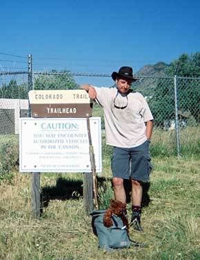
“The Journey of a Thousand Miles Begins With a Single Footstep”
A railroad once ran this way, carrying passengers from
I didn’t spot any of the big horn sheep for which the canyon is justly famous, but then, I was cranking out the pace and before long I was taking a break at the end of the dirt road and preparing to set out on the trail proper. I was a tad concerned about the hot spots which were appearing on the balls of each foot, but a couple of squares of moleskin should do the trick and I was soon heading into the trees. This is much more like the thing and even though the climb had my calves squealing in protest, my spirits were bouncing.
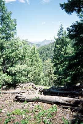
Up and up I went, telling myself that by definition, every hill must have a top. Pine trees lined either side of the trail and the vistas changed endlessly as I switch-backed up the cliff but after a while, I was beginning to wonder about the whole “Every hill must have a top” thing. However, there comes a time when you notice that the surrounding hills are either lower, or not much higher than the one you’re on and that’s a clue that the summit can’t be too far off, out of sight though it may be.
In fact, the summit remained out of sight until I was a few feet from the top where I popped into a clearing to meet 3 mountain bikers debating where to go next. Unlike them, I had a map so I was soon the hero of the day when I showed them exactly what their options were. Good thing too because they’d planned to head the same way I was going and as that wasn’t the circular route they’d thought, would have meant a long ride back.
It took a few hours to get out of the office workers’ mentality of checking my watch every few minutes and fretting about how much was still to be done. Even so, I was pleased to check the pages I’d photocopied from the guidebook (traveling light, remember?) and see that the miles were clicking away quite nicely. By noon I was well over halfway so took a lunch break in the shade of a ponderosa pine and was even more pleased to see that the only other hikers I’d met on the trail, two young guys attempting to hike the CT in one go (and therefore carrying very heavy packs) were looking a lot more tired than me.
Although things could have gone horribly wrong shortly after when I scrambled up a rocky outcrop to take a photo, then couldn’t remember in which direction the trail was. Taking the wrong route down could have led to a lot of backtracking so I was chuffed to get back more through luck than anything else and was soon on my way. And then I was soon stopping again to pull of my boots and socks to reattach the squares of moleskin which were attempting to crawl up my legs. I think I might just have some problems from these hotspots later.
I had thought I was done climbing for the day but no, onward and upward went the trail, as did the temperature so the shade of the trees was very welcome. Every now and then a horizon would open up and I could get a fix on where I was. This was great until I made the mistake of looking behind me and saw that the eastern plains and
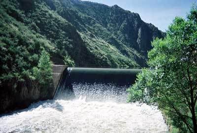
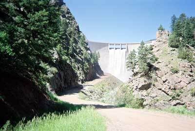
But then I popped out on a cliff top and looking way, way down into the valley, saw not only the river for which I was headed, but Angus the
I’d last seen the two young through-hikers at the top of the hill, looking for a camping spot. That seemed a little premature to me. After all, tomorrow was forecast to be a scorcher and while the segment is only 11 miles, it involves a lot of climbing and takes us through the burned area from the Buffalo Creek forest fire of 1996. Which means no shade and no water. If I were them, I would be looking for a campsite much further down the trail. Still, their packs were much heavier than mine, and I could see why they’d be ready for a break by now.
So, one day done and other than the hotspots on the soles of my feet, which turned into ugly looking blisters later that night, I was feeling pretty darn good about myself.
This is going to be a piece of cake.
1 comment:
I'm SO glad you did this - I know it's only day 1 but I'm so happy for you. I'm quite envious, actually! Hiking is something my body won't allow but if I had a wish, I would ask to hike in the gorgeous Rockies!
Post a Comment